← All work 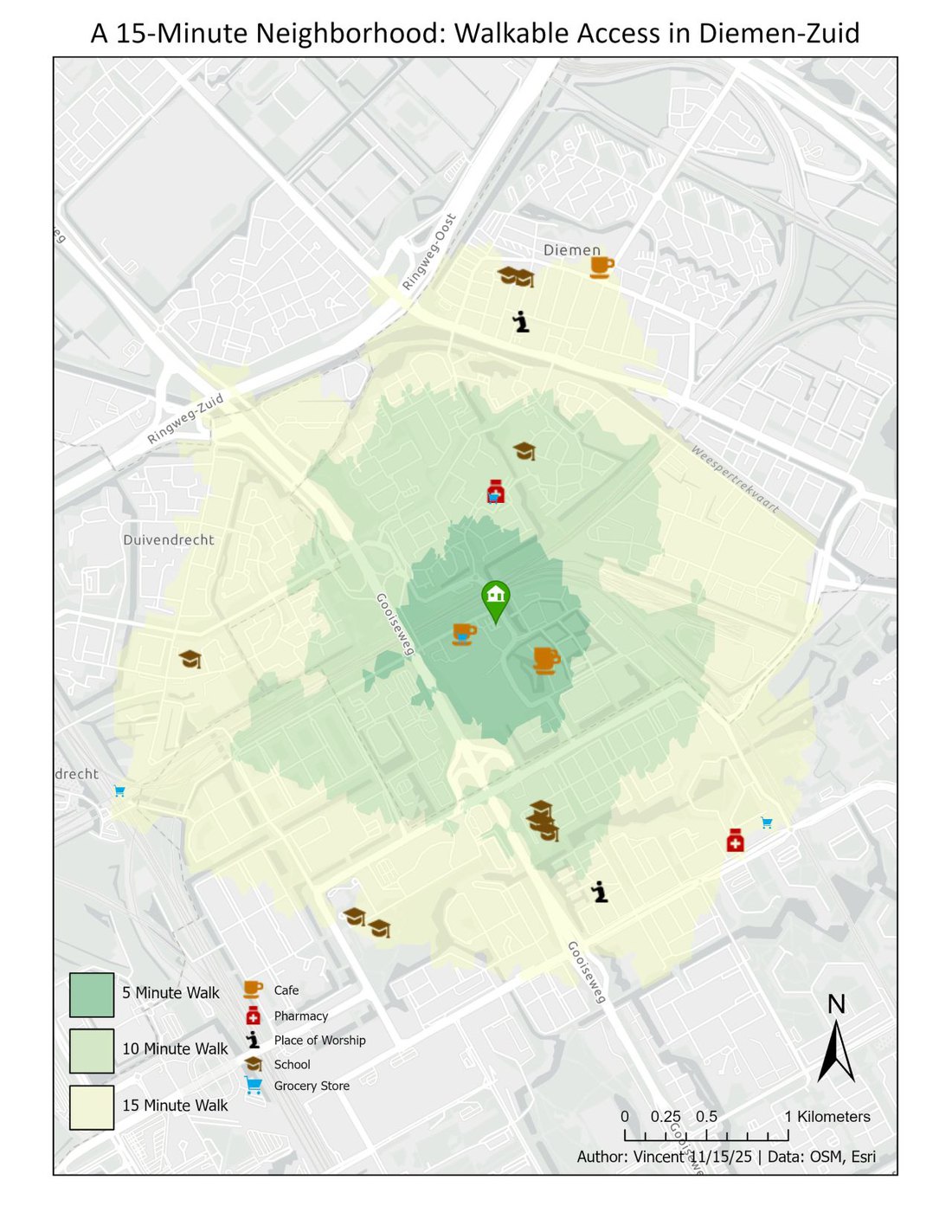
A 15-Minute Neighborhood: Diemen-Zuid
A walkability analysis of my old Amsterdam neighborhood, mapping what is reachable on foot in 5, 10, and 15 minutes.
Using OpenStreetMap data, I analyzed the walkability of my old neighborhood, Diemen-Zuid in Amsterdam. Starting from my former apartment, I ran a network analysis in ArcGIS Pro to generate isochrones (service areas) for 5, 10, and 15-minute walking times, then overlaid OSM amenity data, including grocery stores, cafes, and pharmacies, to visualize what is truly accessible on foot. The result is a benchmark for the 15-minute neighborhood: the kind of everyday walkability that car-oriented cities like Houston could plan toward.
Highlights
- Generated 5, 10, and 15-minute walking isochrones from a single origin with ArcGIS Network Analyst.
- Built the pedestrian network from OpenStreetMap data.
- Overlaid OSM amenities (groceries, cafes, pharmacies) to assess everyday walkable access.