← All work 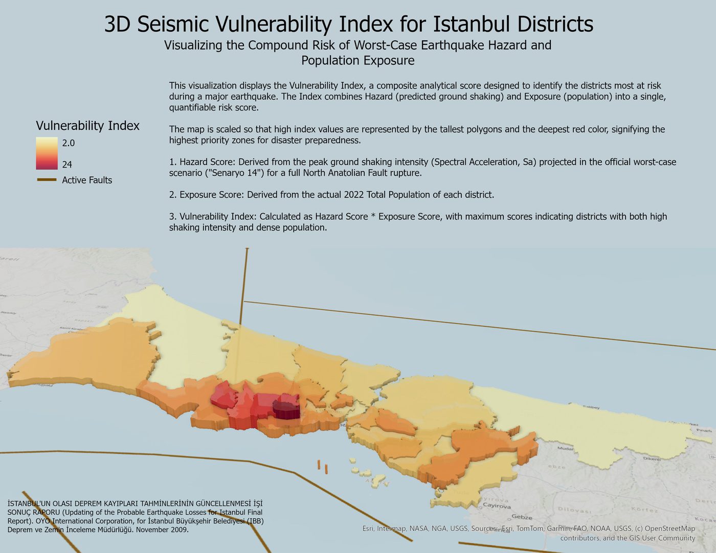
Istanbul Seismic Vulnerability Index
A 3D index combining earthquake hazard and population exposure to rank Istanbul’s districts by risk.
A 3D analytical map that ranks Istanbul’s districts by seismic vulnerability to help prioritize disaster preparedness. The Vulnerability Index combines a hazard score, the peak ground-shaking intensity (Spectral Acceleration) projected for a full North Anatolian Fault rupture under the official worst-case scenario, with an exposure score based on each district’s 2022 population. Multiplying the two surfaces the districts that face both intense shaking and dense population, shown as the tallest, deepest-red polygons.
Highlights
- Combined hazard (projected ground shaking) and exposure (2022 district population) into one vulnerability index.
- Modeled the official worst-case North Anatolian Fault rupture scenario using Spectral Acceleration.
- Used 3D extrusion and a graduated color ramp to flag the highest-priority districts for preparedness.