← All work 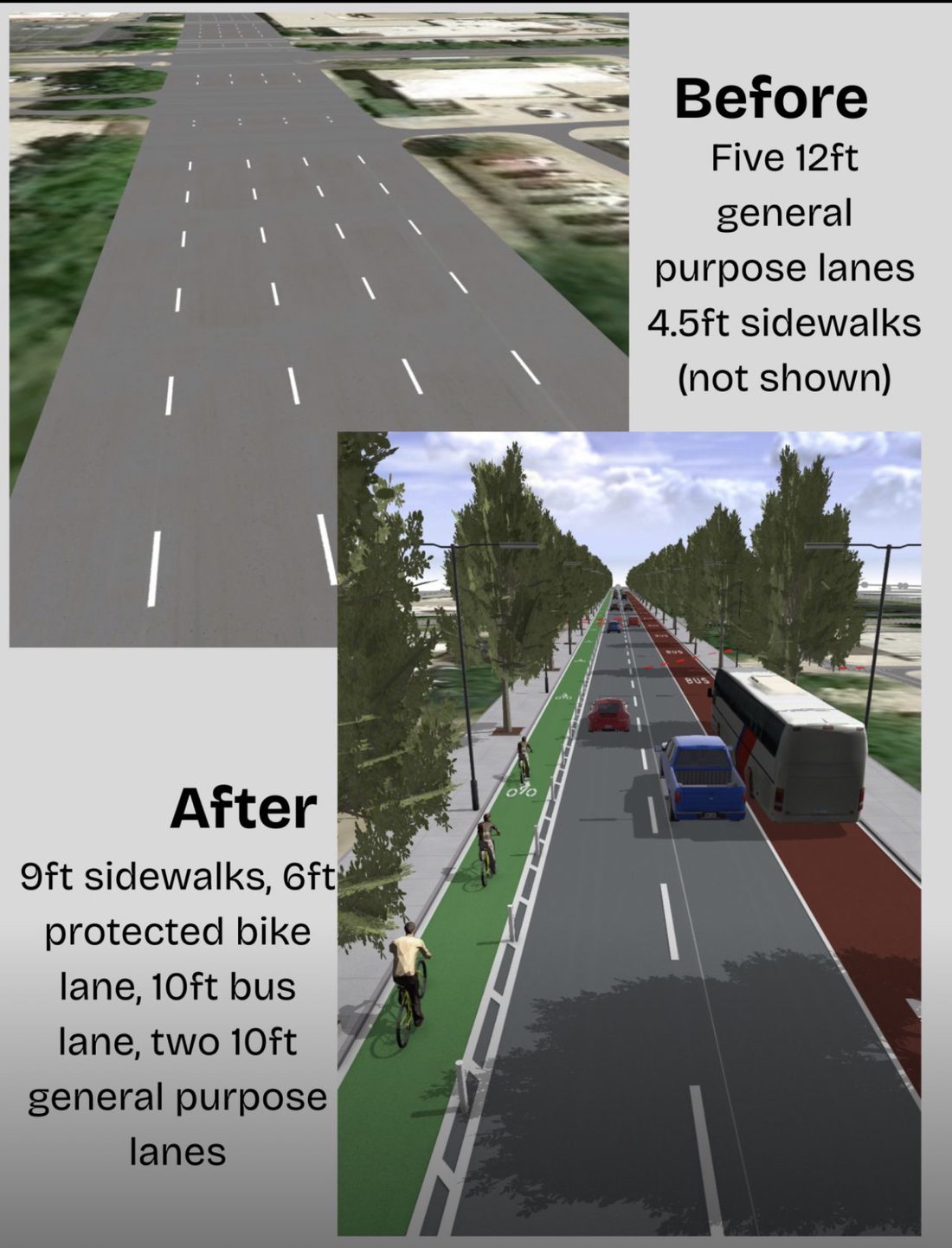
Midtown Houston Complete Streets Visualization
A 3D procedural model exploring how the Louisiana & Smith corridor could be retrofitted for multimodal travel.
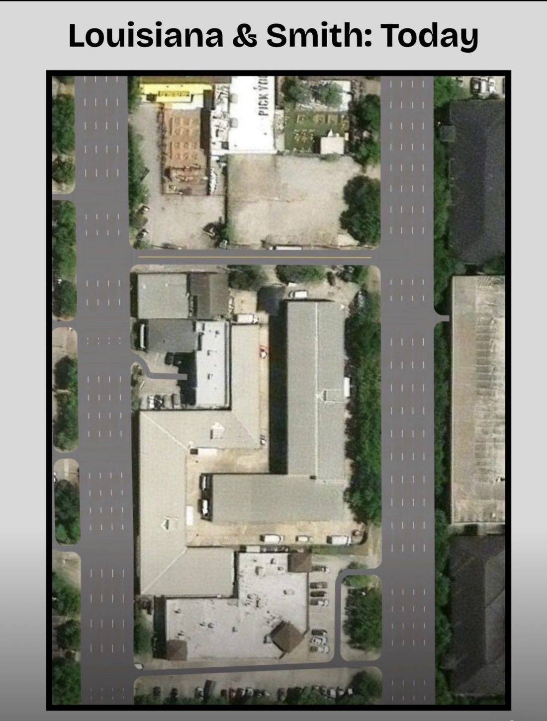
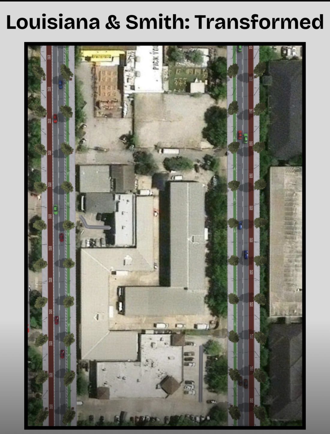
Using ArcGIS CityEngine, I procedurally modeled a 3D retrofit of the Louisiana & Smith corridor to visualize future-state street concepts. The redesign reallocates the existing right-of-way, converting five 12-foot general-purpose lanes and 4.5-foot sidewalks into a multimodal section: 9-foot sidewalks, a 6-foot protected bike lane, a 10-foot bus lane, and two 10-foot general-purpose lanes. It demonstrates the spatial feasibility of road-diet interventions using only the street width that already exists.
Highlights
- Procedurally modeled a 3D before-and-after retrofit of the Louisiana & Smith corridor in CityEngine.
- Reallocated five 12ft car lanes into 9ft sidewalks, a 6ft protected bike lane, a 10ft bus lane, and two 10ft general lanes.
- Showed road-diet feasibility within the existing right-of-way, with no widening required.