← All work 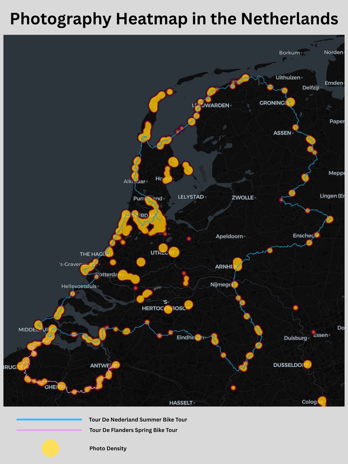
Photographic Footprint of the Netherlands
A heatmap of 13,000 geotagged photos from my semester abroad, layered with GPX tracks from two long-distance bike tours.
For this project I mapped my own “photographic footprint” from a semester studying abroad in the Netherlands. Using a macOS command-line tool, I extracted the latitude and longitude metadata from all 13,000 images in my photo library, then loaded the points into Kepler.gl to build a density heatmap. The hotspots immediately revealed where I spent my time, in cities like Amsterdam, Rotterdam, and Utrecht. Noticing the heatmap traced my long-distance rides, I overlaid GPX data from two cycling trips, the Tour De Nederland and Tour De Flanders, combining a density layer of everyday life with line data from specific events.
Highlights
- Extracted GPS metadata from 13,000 personal photos using a macOS command-line tool.
- Built a density heatmap in Kepler.gl, surfacing hotspots in Amsterdam, Rotterdam, and Utrecht.
- Overlaid GPX tracks from two bike tours (Tour De Nederland and Tour De Flanders).
13,000 geotagged photos mapped