← All work 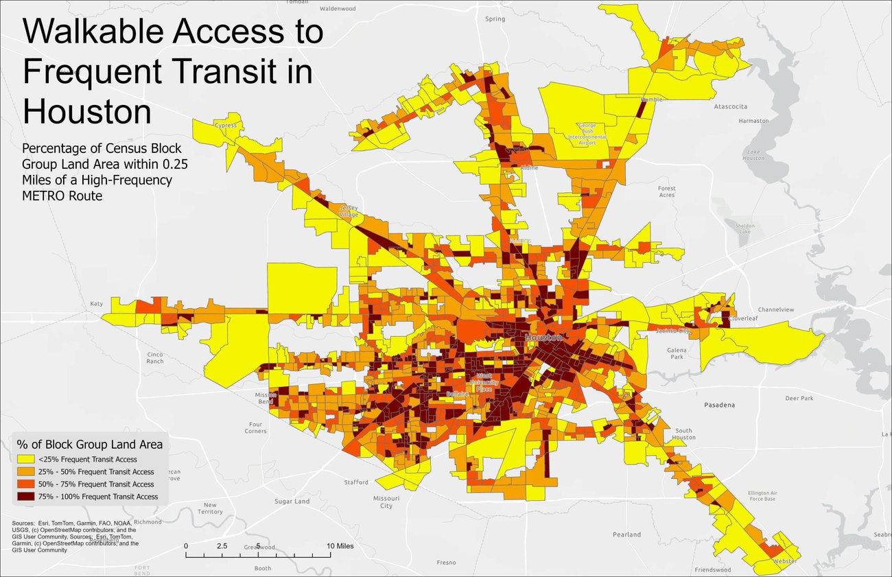
Houston Transit Equity & Frequency Study
Mapping METRO’s high-frequency network against population to find gaps in access to frequent transit.
This study maps the METRO high-frequency transit network using GTFS data to identify critical service corridors. By overlaying quarter-mile walk buffers onto block-group population data, it computes accessibility metrics and visualizes where service coverage gaps line up with socioeconomic disparities in access to frequent transit. The result is a map of where frequency upgrades would reach the most underserved riders, a starting point for prioritizing METRO investment.
Highlights
- Mapped the METRO high-frequency network from GTFS data to identify service corridors.
- Computed accessibility by overlaying 0.25-mile walk buffers on block-group population.
- Visualized coverage gaps to surface disparities in access to frequent transit.