Vision Zero Houston
Pharis Fellowship research asking whether Houston knows where its dangerous streets are.
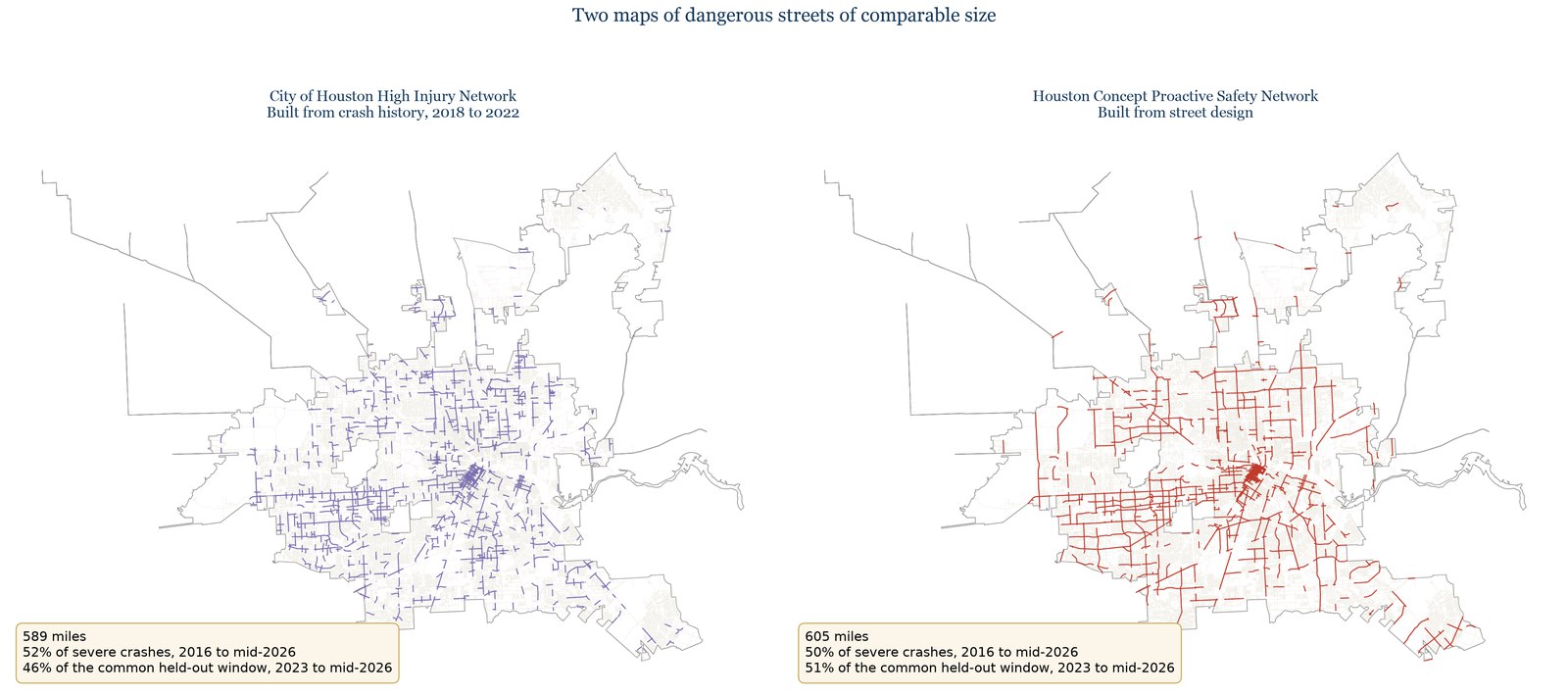
For my Pharis Fellowship with the University of Houston Honors College and HPE Data Science Institute, in partnership with the office of Council Member Joseph Panzarella (District C), I built a citywide answer to one question: does Houston know where its dangerous streets are? The project has two halves. The first is Vision Zero Houston, a public dashboard that makes 421,679 state crash records (2016 to mid-2026) across 66,922 street segments explorable by street, council district, neighborhood, travel mode, and time of day, with one-click printable reports for council use. The second is a proactive street-design risk model: a negative binomial crash-frequency regression, supplemented with computer-vision features (SegFormer and Faster R-CNN) extracted from 59,261 street images, validated spatially on held-out council districts and temporally on crashes the model never saw. Frozen at the end of 2021 and graded on 2023 to mid-2026, the design model captured 51% of future severe crashes versus 46% for the City’s crash-history High Injury Network at matched mileage, and flagged roughly 300 miles of high-risk streets missing from the official network, where 574 severe crashes later occurred. Street design, not crash history alone, tells a city where harm lands next. I sole-authored the resulting paper, submitted to the Transportation Research Board (TRB) 2027 Annual Meeting.
Highlights
- Built a public citywide dashboard making 421,679 crash records across 66,922 street segments explorable by street, district, neighborhood, mode, and time.
- Modeled crash risk from street design: negative binomial regression plus computer-vision features (SegFormer, Faster R-CNN) from 59,261 street images.
- Validated spatially and temporally: the design model captured 51% of held-out severe crashes vs 46% for the City’s High Injury Network.
- Identified roughly 300 miles of high-risk streets missing from the official network, where 574 severe crashes later occurred.
- Sole-authored the paper, submitted to the TRB 2027 Annual Meeting.
Open the live dashboard ↗ Read the paper (PDF) ↗ View the code on GitHub ↗